RhinoTerrain sera présent aux GéoData Days

We are pleased to announce that RhinoTerrain will be participating in GéoDataDays 2025, the leading event dedicated to geospatial data in France.

Dates: September 10–11, 2025
Location: Parc Chanot, Marseille

For this 7th edition, over 100 exhibitors, 130 experts, and 1,600 participants from the geomatics community will gather — including local authorities, companies, public institutions, and researchers.

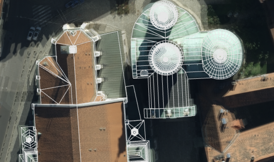
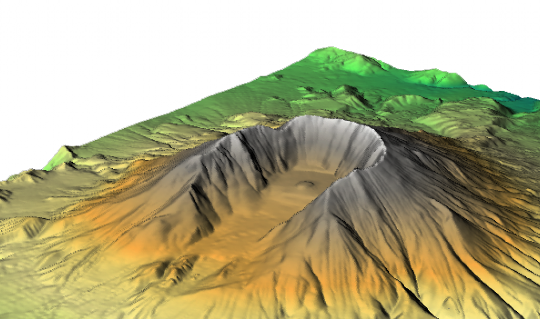
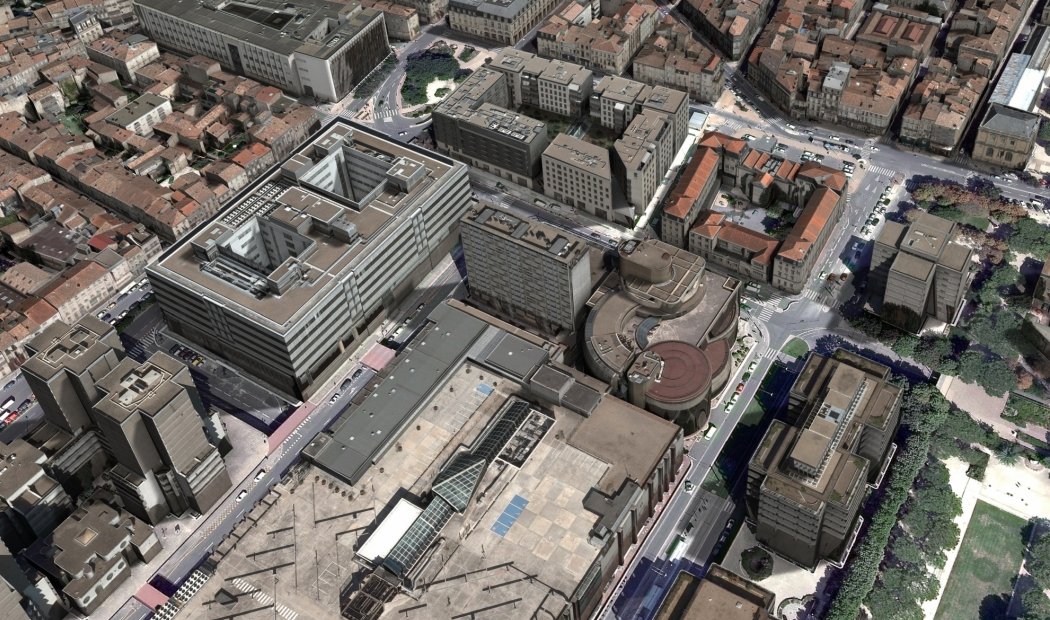
Come meet our team at our booth to discuss your projects, explore our 3D solutions, and attend live demonstrations.
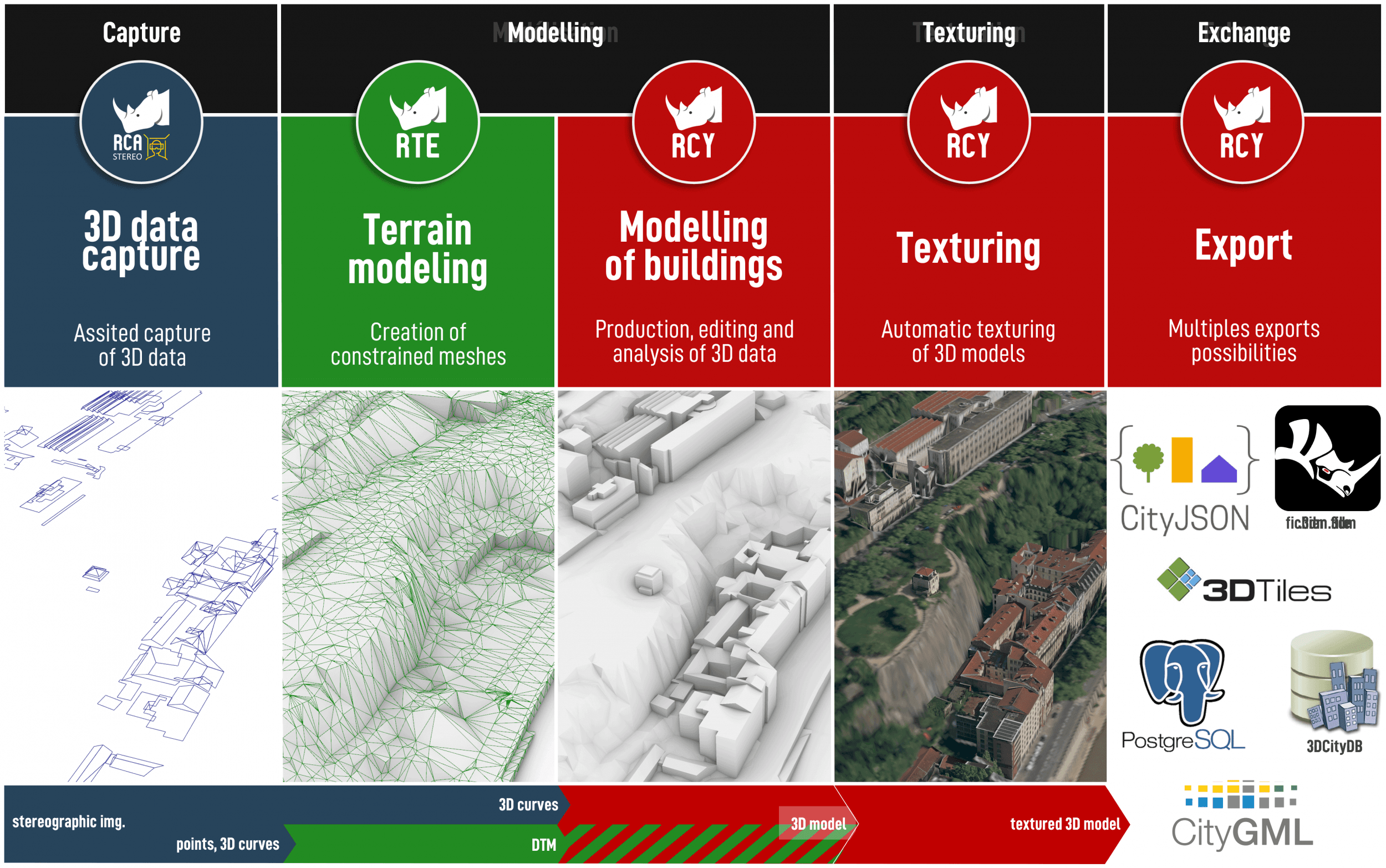
We will also take this opportunity to unveil our latest plugin designed to harness aerial imagery in 3D.

Don't miss this major event — see you soon in Marseille.

An innovative company

Founded in 2008 by specialists in geomatics and 3D imaging, RhinoTerrain SAS was the national winner of the iLAB competition, which supports the creation of innovative technology companies.

We develop a range of 3D geomodeling software that meets the needs of various fields of application: GIS, 3D urban data production, civil engineering, 3D engineering, photogrammetry, and solar calculations.
Our range of 3D GeoModeling solutions is based on Rhinoceros® software. 

 
Oxalis

Discover a
unique
stereoscopic viewing

Oxalis extends the 3D capabilities of Rhinoceros by enabling vision stereoscopic viewing.

Thanks to its ability to display stereographic image pairs, view your aerial images directly in 3D!


Discover Oxalis
 
 
rhinoCapture

Computer-assisted
3D capture

RhinoCapture offers photogrammetrists new assisted capture tools. Coupled with a 3D stereoscopic station, the use of parametric roof models facilitates capture and guarantees the effortless production of topologically accurate geometric data that complies with coplanarity and orthogonality constraints.


rhinoTerrain

A powerful Digital
terrain modeler

rhinoTerrain™ enables the calculation and editing of Digital Terrain Models (DTM) . Based on an innovative, robust, and reliable constrained triangulation algorithm, it is capable of processing very large volumes of data.


Discover rhinoTerrain
 
rhinoCity

To produce, edit,
analyze and texture
3D data


Featuring a unique 3D building modeler and extensive automatic texturing capabilities, rhinoCity is the ideal tool for producing high-quality textured 3D data than be used directly in CityGML format.


rhinoSolar

The solar potential
of your infrastructure
finally revealed !

The use of a complete 3D model (land, vegetation, buildings) combined with mathematical and physical models makes RhinoSolar a powerful tool for developing a Solar Cadastre and studying urban heat islands (UHI).
unified 3D data production chain

Although they are independent of each other, our
rhinoCapture STEREO, rhinoTerrain and rhinoCity
software programs can be combined to form
a complete workflow for 3D data production.


Our references

Belfort
Bordeaux
Brest
Cannes
Dijon
ENGIE
Eurosense
Gatineau
Hanovre
IGN
Le Havre
Lyon
Metz
Monaco
Montreal
MTSI Europe
Neuchâtel (CH)
Nices
Paris
Rennes
Strasbourg
Toulouse
Vinci

Newsletter
Subscribe to stay informed