
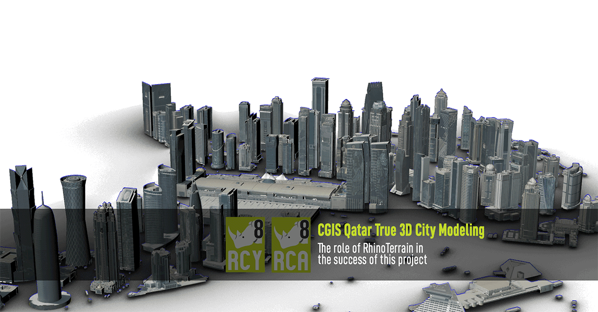
CGIS Quatar
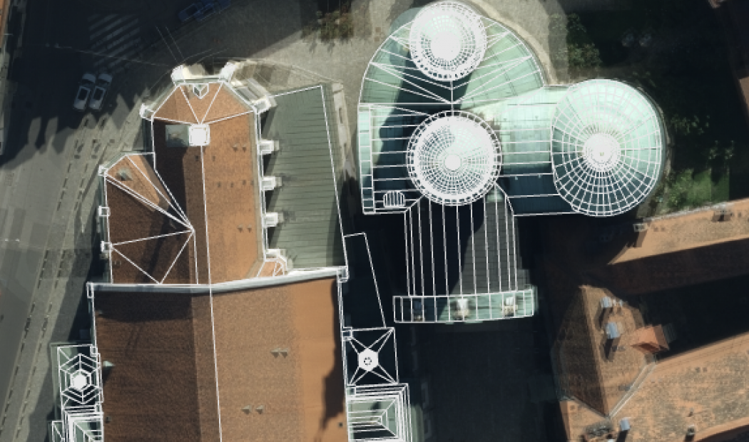
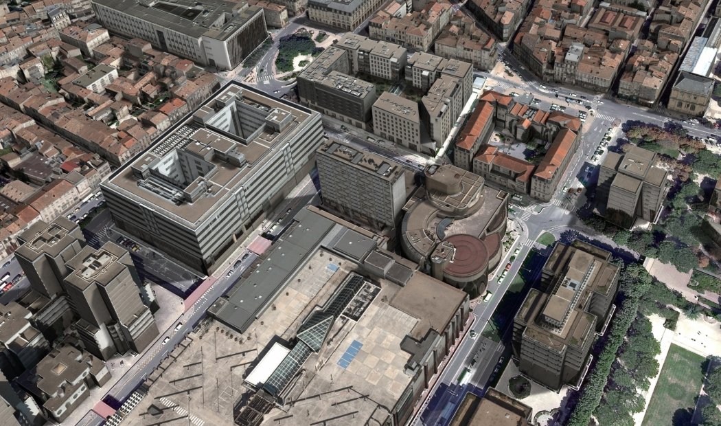
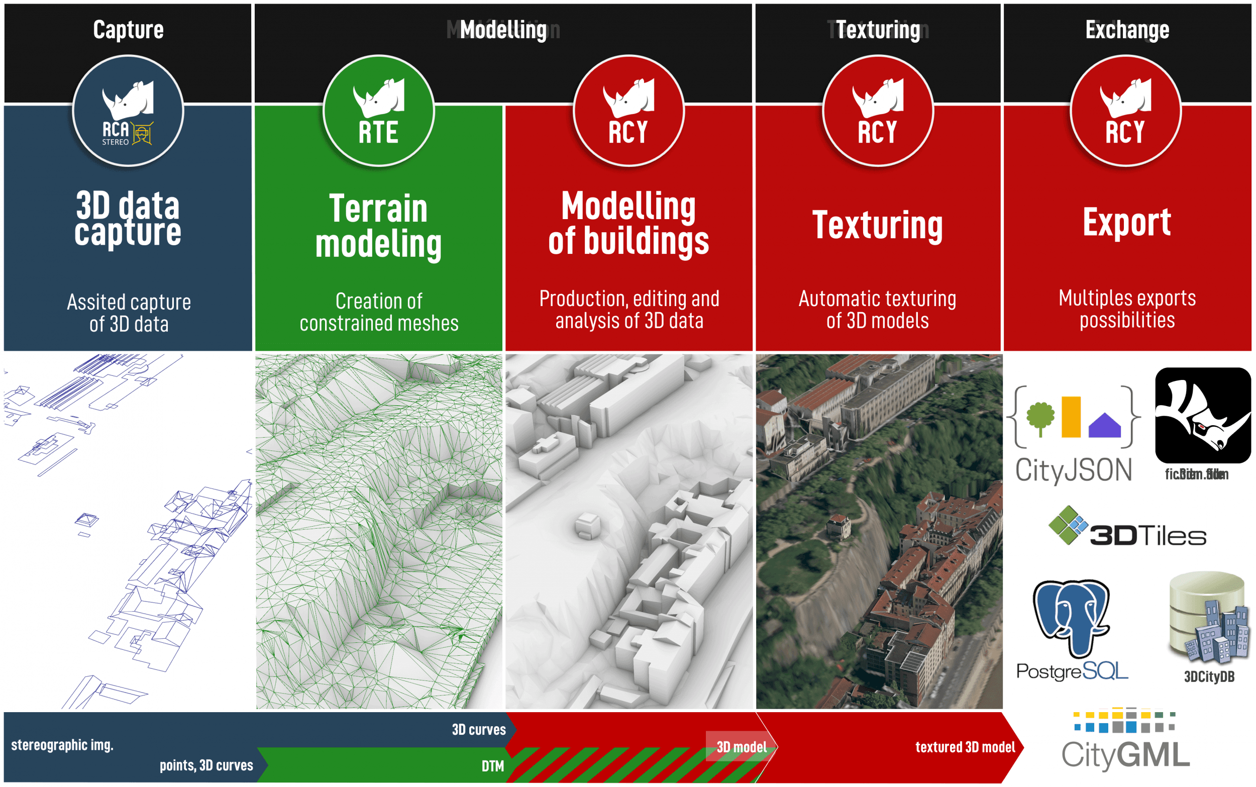
The Center for Geographic Information Systems (CGIS), Qatar's geospatial agency, has produced a 3D urban reference model to support urban planning, infrastructure management, and smart city applications enabled by such a digital twins.The resulting 3D model represents:
– 218 km² covered (16 urban areas)
– 43,310 buildings in Level of Detail (LOD) 2 and 300 in LOD 3
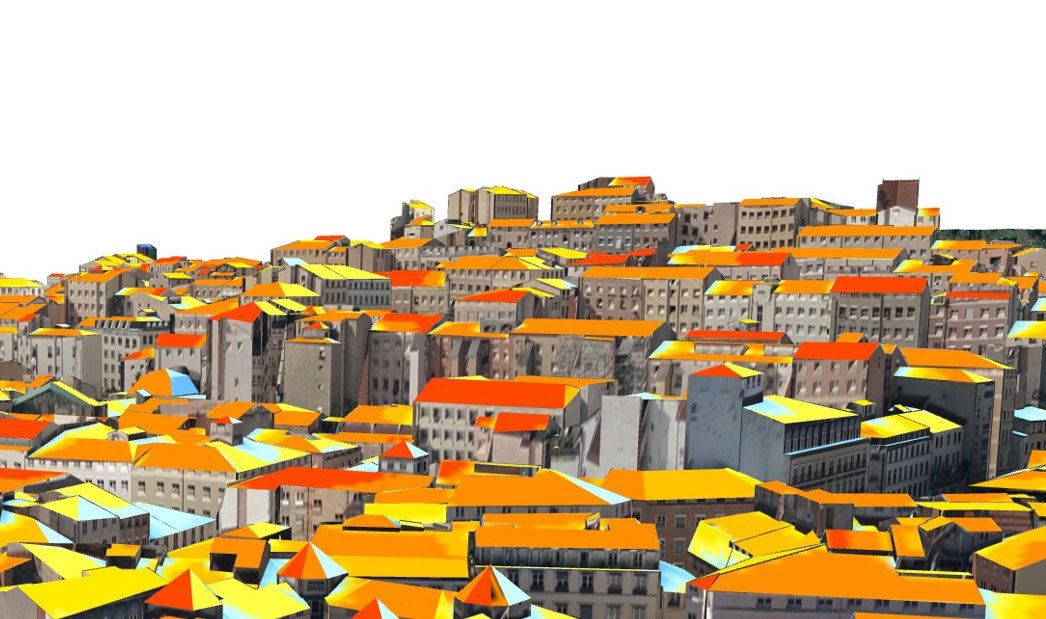
– a high-quality, textured, geometric 3D model in CityGML format.This project showcases a production chain ranging from aerial acquisition to textured 3D modelling, utilising Vexcel Imaging solutions (UltraCam Osprey 4.1 camera and UltraMap software) as well as RhinoTerrain's 3D data production software solutions: RhinoCaptureTM and RhinoCityTM:
— RhinoCapture™ is used for 3D digitisation and vectorisation in a stereoscopic environment, with constant control of capture quality.
— RhinoCity™ is used for:
- Automated generation of 3D models (LOD2/LOD3)
- Automated texturing of the model using aerial images
- Generation of all objects in the 3D model in CityGML format.Creating this textured 3D model in CityGML format demonstrates the relevance of our solutions, offering quality and geometric consistency, automated texturing capability, interoperability, and metropolitan-scale delivery.
We are proud to have contributed to a project for the CGIS alongside Vexcel Imaging and all partners, which concretely illustrates the benefits of vectorised 3D for territories.Special mention goes to our local representative, Aeromap Technology Systems, the distributor of the solutions that modelled this incredible city!Read the study published by Vexcel: https://www.vexcel-imaging.com/2025_CGIS_CaseStudy_3DCityModel_Vexcel.pdfTo learn more about our textured 3D model production and interoperability solutions, visit our website:
/fr/rhinocapture.html
/fr/rhinocity.html
– 218 km² covered (16 urban areas)
– 43,310 buildings in Level of Detail (LOD) 2 and 300 in LOD 3
– a high-quality, textured, geometric 3D model in CityGML format.This project showcases a production chain ranging from aerial acquisition to textured 3D modelling, utilising Vexcel Imaging solutions (UltraCam Osprey 4.1 camera and UltraMap software) as well as RhinoTerrain's 3D data production software solutions: RhinoCaptureTM and RhinoCityTM:
— RhinoCapture™ is used for 3D digitisation and vectorisation in a stereoscopic environment, with constant control of capture quality.
— RhinoCity™ is used for:
- Automated generation of 3D models (LOD2/LOD3)
- Automated texturing of the model using aerial images
- Generation of all objects in the 3D model in CityGML format.Creating this textured 3D model in CityGML format demonstrates the relevance of our solutions, offering quality and geometric consistency, automated texturing capability, interoperability, and metropolitan-scale delivery.
We are proud to have contributed to a project for the CGIS alongside Vexcel Imaging and all partners, which concretely illustrates the benefits of vectorised 3D for territories.Special mention goes to our local representative, Aeromap Technology Systems, the distributor of the solutions that modelled this incredible city!Read the study published by Vexcel: https://www.vexcel-imaging.com/2025_CGIS_CaseStudy_3DCityModel_Vexcel.pdfTo learn more about our textured 3D model production and interoperability solutions, visit our website:
/fr/rhinocapture.html
/fr/rhinocity.html


")


